Final “tough” week of training.
Monday: 6.4 mi, treadmill
Tuesday: 3.1 mi, paved trail (Centennial Lakes)
Wednesday: 8.9 mi, paved trail + road (2.9 @ Centennial Lakes, 6 road)
Thursday: 3.6 mi, road
Friday: rest
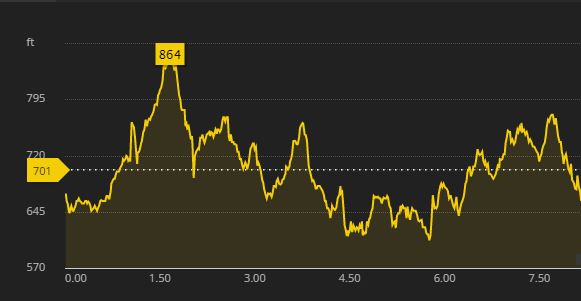
Saturday: 15.5 mi, trail (Superior Hiking Trail – Superior 25K)
Sunday: 4 mi, paved trail (Lakewalk)
Total: 41.5 mi
Monday I had to hit the treadmill due to the weather, which sucked. I powered through as best I could, but I am not used to it anymore!
Tuesday I went to the Twins game (the Bulldogs men’s hockey team was being honored before the game), so I brought my stuff to work and ran at lunch. It was very warm. I walked probably another mile at the Twins game because I lost my cell phone. Brilliant. It turned out it was in one of those doggy dishes they use at the security checkpoint. So I lost it right away. Sigh. The Twins won, though! And I had a delicious ice cream served in a mini-helmet.
Wednesday I knew I wanted to knock out some extra miles. It was hot again, so I didn’t want to do them all at once, and decided to split my run between work and home. I didn’t intend to run as far in the evening, but I chose to run to the State Capitol grounds. It’s a mini-goal I set for myself (I should have saved it for my summer goals post!) – to run from my house to the Capitol grounds. I found all kinds of places I need to explore along the way – like the Tim Horton’s and the Candyland. I need to explore some chocolate-covered potato chips, yes. I also need to go walk the Capitol grounds and see all that there is to see there. I should make a St. Paul exploration checklist for my spouse and me to check off.
Thursday I ran a quick jaunt around my neighborhood. It felt kind of labored, but I got it done. Friday I headed north for the race, and spent several hours on my feet hawking Rocksteady Running gear.
Saturday was the race, already covered in the report linked above. After the race, I felt a lot better than I have in years past, and after a shower, some chili, and a bit of time lounging around tinkering on the internet, we decided to go on an adventure. We started out at the Onion River, just south of Lutsen, right off Highway 61. I questioned why I had agreed to hike uphill for probably almost a mile, but I had the energy, so I did it. We took some pictures along the way, then turned around and hiked back down.
We got back in the car and headed north, planning on going to Grand Marais for dinner, and to kill time with whatever we could find in the meantime. The weather had improved from gray and windy to intermittently sunny, which made the hiking a lot better. We pulled over at Cascade River and hiked around there a little bit, and then decided we might as well go to Devil’s Kettle, so we ended up there. THAT was at least a mile’s hike in, and included 176 stairs at one point. Thank you, Satan.
After that hike, we were ready to head into Grand Marais. Last year, we walked out along the breakwater to the lighthouse, but were too cold to hike out on the other side of the tombolo, so we decided to finish that journey this year. It wasn’t a long hike, and it was gorgeous at the end. The water looked so clean and clear, and the lake stretched on endlessly into the horizon, without Wisconsin in the distance to ruin things. I’d say conservatively we hiked 4 or 5 miles, which was tiring but also helped me avoid a lot of stiffness and soreness. We also made the most of our trip, unlike last year when I didn’t have the energy or inclination to do much additional exploring.
Sunday we headed back down to Duluth, since I am working here until Wednesday. We decided to make another adventure of the trip back, and stopped at Tettegouche State Park, where we hiked another mile or so to see Two Step Falls and High Falls, then hiked back out (obviously) and drove to the rest area at the entrance to the park, since my husband tripped and cut his hand while we were hiking and wanted to wash it out before we continued the drive. He powered through the hike though! We stopped just down the road at Palisade Head, which isn’t really a hike, since the road goes to the top. Palisade Head is impressive to look at, and it’s exhilarating to stand so high above the lake and look out in the distance. I was a little too nervous to get close to the edge to look over, but I still reveled in the experience from a safer distance.
After we got to Duluth, visited my grandparents, and went to see Deadpool 2, I went for a short run on the Lakewalk to complete my weekly mileage goal (running only – obviously I exceeded that with hiking). It was so nice to be back there. I’m feeling so torn between my new home in St. Paul and my old home in Duluth. I really thought I was adjusting to the transition – until I came back here.
It’s time to start winding down the mileage to rest my legs for FANS. I am hoping to run at least 36 more miles in May, in order to beat last month’s mileage, but I’ve got plenty of time to get that done.